The Pilots Atlas Eastern Hemisphere (Europe, Middle East and S.E. and Asia)

Hurry! only 1 items left in stock.
159.00 Lei
Tax included
Lowest price of the product in the last 30 days: 159.00 Lei
Quantity

In stock
 

Product Warranty and After-Sales Services Policy


Delivery, Shipping and Showroom Collection


Returns Policy and Right of Withdrawal

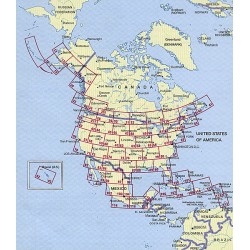
JNC scale, topographical charts are used showing over 4,500 airports Waypoints, VOR/DME, NDB´s and special use airspace are included, plus weather frequencies, points of interest, landmarks, airport-directory with ICAO-codes, railways, rivers, major highways, just to name a few. Airports are colour coded by runway length and surface. International/ regional Aerodromes are coded by symbol shape. Pilots now have the ability to point out objects on the ground or know immediately where they are in relation to surrounding airports or points of interest: an all-in-one source of information for pre-flight or during flight.

Hurry! only 1 items left in stock.

Data sheet

Format
Printed Book

Big Changes:

•  Completely new cartography
•  Completely new aeronautical data
•  new airport directory
•  new overview maps
•  new Captain's Corner
•  Expanded Area
•  16 additional pages cartography
•  now 224 pages content◦158 pages maps
◦  39 pages Captain's Corner
◦  27 pages overviews
•  complete Atlas is printed in color
•  with ICAO-codes, waypoints, VOR's, NDB's, etc.
•  restricted, prohibited and danger areas
•  High quality, foiled cover
•  size 20 x 28cm / 8 x 11 inch

Reviews

No customer reviews for the moment.

Reviews can be placed by customers that purchased this product

1 other product in the same category: